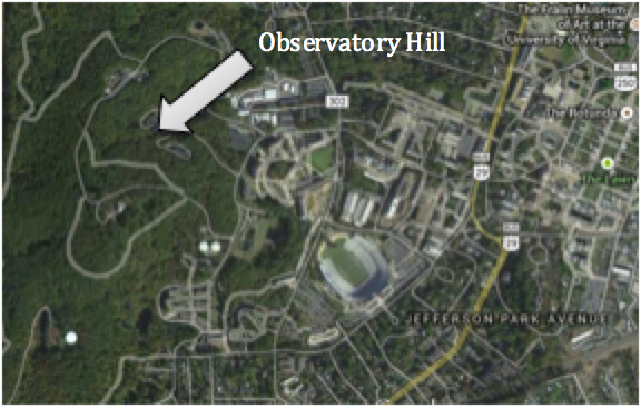
Located just west of University of Virginia’s central campus, Observatory Hill is the largest green space on campus. Observatory Hill offers the University many unique opportunities including environmental, recreational and educational uses. Having an area as large as OHill dedicated to forest has many environmental benefits. First, trees improve both the macro and micro-climate of an area. Trees have a cooling effect and help to combat the “heat island effect” caused by paved areas. Trees are also a key component of mitigating the greenhouse effect by sequestering carbon. Second, improve air quality by serving as natural air filters; they remove dust and pollutants such as CO2 from the air and release O2 back into the air. Lastly, trees improve water quality by reducing storm water runoff. In terms of recreational advantages, Observatory Hill contains many trails that are frequented for hiking, dog walking and biking. These recreational activities allow students and individuals in the Charlottesville community convenient opportunities to enjoy nature. Furthermore, Observatory Hill allows ample options for classes and students to study and learn from the forest, gaining valuable knowledge of ecology, hydrology and much more!
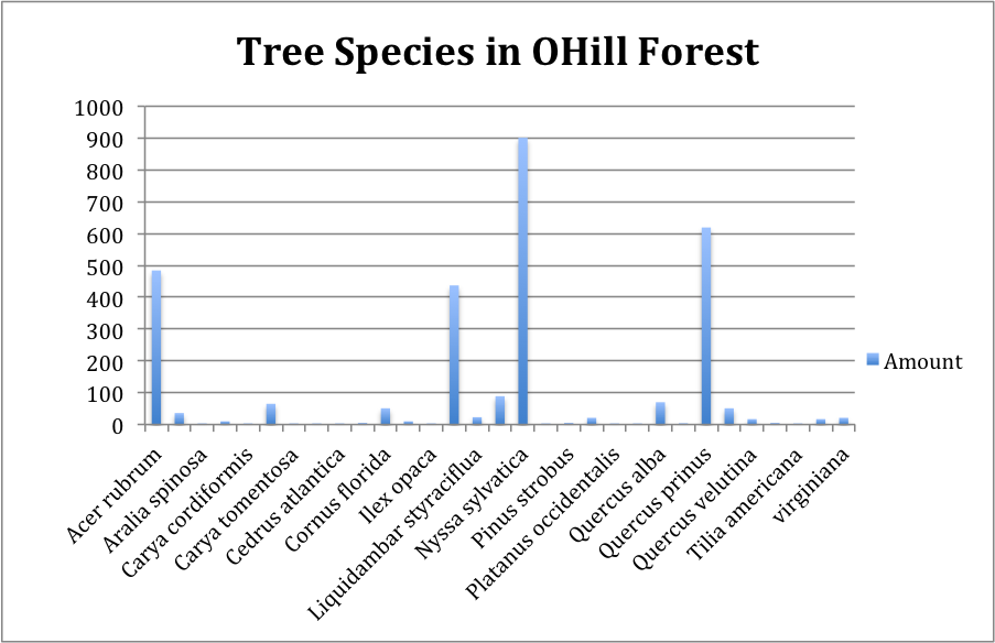
The Ecology Department at the University has conducted several studies over the years to identify and document the biodiversity of the forest. 2920 trees were identified, covering a range of 31 different species (see chart for species and specie counts). The four dominant species of trees included: Nyssa sylvatica, Quercus prinus, Acer rubrum, and Kalmia latifolia. The largest trees in the forest though were the Quercus prinus and the Liriodendron tulipfera, with basal areas ranging from 24661-5178 cm^2. The smallest trees were Kalmia latifolia and Nyssa sylvatica, with basal areas ranging from 2-7 cm^2. The biodiversity of the forest supports a rich ecosystem, providing habitats for a plethora of other organisms and ensuring a more sustainable forest.
Identifying and documenting tree species in an area as large as Observatory Hill can prove to be challenging, but there are many tactics one may use to conduct this task. The method used to study Observatory Hill included plotting out areas and documenting the species located in each plot. First, plots were established using a GPS and marked with rebar and tag. Within the plot, trees were identified using a tree ID handbook, the distance of the tree from the center of the plot and the angle from North was measured, each tree was marked with tags, and height measurements for a few trees were recorded using a clinometer. Lastly, a 2m transect though the center of the plot was established and all seedlings and trees were counted and measured.
Tree identification has become easier than ever with the rise of computer and telephone applications. Virginia Tech created the Virginia Tech Tree Identification application that allows users to identify trees with just a click of their phone! The application contains information on over 900 North American plants, including pictures and map ranges for each species. The application lays out a series of questions that allows for quick identification of species.
(Source: UVA Ecology Department, Atticus Finch)
Post by Taylor O’Leary

